My First Solo trip : Gokarna

I heard about this place from a couple of my friends. If you want to relax on a beach doing nothing, no party, no booze, no bright lights, close to Goa in distance but far away in terms of vibes, go to Gokarna.

Located at Karnataka – Goa border, this place has a couple of small beaches where you have to trek to reach. This place is famous for its beautiful OM beach which is in the shape of OM when seen from a height from a distance. It was Feb 2017, I was struggling with my job i was frustrated, I used to work in adventure travel and it was it working out. I couldn’t do sales, could not reach my target and I was super bored with the monotony. My friend went to Gokarna a week back and did not stop telling me about that place. I too wanted to go to this place since a long time.

DCIM100GOPROGOPR1030.JPG

Taking a leave on a Friday, i booked my tickets to Gokarna. I was sceptical, i was afraid. Afraid of getting bored, afraid of getting robbed, afraid of making a fool of myself, afraid of anything and everything, but i decided – never try, never know. I sat in the bus still scared about the experience. Reaching Gokarna road at wee hours the next morning, a couple of people from the bus got down at out stop. Taking a sharing taxi we all reached Kudle beach. I was all dark till that time. I sat on the beach watching sunrise. “Om beach is the best beach to stay in Gokarna” my friend told me so i started walking towards Om beach. As i was walking i could see people doing Yoga, couples moving around holding hands, people working out. I liked the vibe of this place.

It was difficult to find a place to stay at Om beach as Gokarna is filled with majority of foreigners (Israelis and Russians mostly) who stay there for weeks and months and OM beach is one of the best places to stay. After searching for a place for almost two hours, I had to go back to Kudle to find a place to keep my luggage. I was so tired that i stayed in the first guest house as soon as i reached Kudle. I wanted to spend more time at Om beach so i chose the guest house closest to Om. The guest house was one of the oldest kind of structure i had ever seen, but it was bang opposite to the beach and i got it in 400 bucks. The washrooms were common, but who cares the place was lively, the rent was cheap and the girls were beautiful.

DCIM100GOPROGOPR0947.JPG

I roamed around Om beach on day one, read book, swam and finally started talking to people. In the evening a couple of Israelis were playing some musical instruments and a couple of then were dancing, it was amazing. Dancing in some foreign tunes under the open sky next to the sea, the experience cannot be described.

Next morning from Kudle, i trekked to Om beach, from Om beach to Paradise beach and from Paradise to Half moon beach. It was a long walk. So let me tell you some things about the beaches in Gokarna. There are four beaches :

Kudle : This is a first beach you get to when you reach Gokarna, mostly filled with Indians and family crowd. You can find hotels and guesthouses on this beach.

Om beach : One of the most beautiful beach ever. Om shaped when seen from a height. Hippie vibes, majority foreigners. You can find hotels, guesthouses, shacks and hostels on this beach.

Paradise beach : Very small beach with a small pool kind of structure before the sea. Only one cafe. Must visit place.

Half moon beach : The last beach in the area. No cafe, no shack available. Only the one’s who have their own tent can stay here. This is a paradise for Hippies and budget travellers. I met a couple of Russians on this beach who were staying here from days in their tent because they didn’t want to spend money on accommodation. You won’t miss a thing if you avoid this beach.

DCIM100GOPROGOPR1020.JPG

In the evening on both the days, Om beach which was mostly filled with foreigners, you to get extremely lively, with people playing with each other, listening to their songs and dancing to the tune of the sea. This trip taught me a couple of things like: how to take care of myself when i am alone. how to make new friends when you are bored, how to enjoy your own company, how to let go of things which are not under your control, how your worries are temporary and you are bigger than then and lastly, how travel heals everything.

I got back to Pune the next day and i over achieved my target.

If you want to experience beaches and peace or you are bored of going to Goa. Gokarna is the place for you. Go there and thank me later.

For more info on Gokarna, you can connect with me at prashant@hillsandbeyond.com

Reasons to visit Ladakh

Ladakh means the “land of high passes”. It has been a dream destination of most of the India’s youth. Everyone wants to go to Ladakh and explore the rustic trans Himalayas, the barren land, the high altitude lakes, the beautiful monasteries, and many more. Leh is the headquarters of Ladakh where one has to stay for acclimatisation purpose and the place filled with numerous cafes, bars and trekking shops. There are multiple stay options here in Leh. You can stay in a home stay, hostel, hotel or a guest house ranging from as cheap as Rs. 400 per bed to Rs. 20,000 per room. There’s a list of some places you can visit in Ladakh :

ashwini-chaudhary-QJDHrCCr0ac-unsplash

1. Khardung La : The highest motor able road in the world. This pass at a height of about 5600 m above sea level is a major attraction in this region because of its height. Being the highest road in the world, it attracts a lot of tourists from all over the world. This pass also connects Leh with Nubra valley. This place is a mecca for a lot of adventure seekers : Bikers for the breath taking roads, cyclists for the endurance and thrill of riding on this strenuous terrain and runners to make a mark in their memory by running on this high altitude pass. At the top of the pass, there is a military cafe where you can treat yourself with snacks and beverages. One thing you should keep in mind before going to this pass is you need to acclimatise well in Leh as it is quite high in altitude and may cause Acute Mountain Sickness. My personal favourite adventure at this pass is going up by a car and cycling back down, the narrow cuts, the speed gives you an high of your own.

ayandrali-dutta-GAWiEPB0uEk-unsplash
Zanskar and Indus river Sangam

2. Hall of Fame : Leh Hall of Fame is another major attraction in Ladakh. Surrounded by snow capped mountains and Stok Kangri in the back drop, this place is a museum keeping the memories of the Kargil war. It shows the history of Ladakh as well as the of the war on 1971 and 1999. In its display it has captured weapons of the Pakistan army. Every evening there is a parade and a small 20 minute movie on wars faced by India earlier.


3. Turtuk : A place which was in Pakistan until the 1971 war, where the local language is Balti, which is located 7 km from the India – China border Turtuk has opened up for civilians only 2 years back. If you want to see the untouched place in Ladakh, this is the one. Turtuk is located around 80 km from Hundar and almost 186 km from Leh. It has one army school, two museums, one palace, a river flowing which divides the village in two parts, one small monastery, a turtuk view point and multiple amazing cafes. This tiny village is so disconnected with the world that it gets electricity for only 4 hours a day and there is no network connectivity. If you have to get in touch with someone in your family or friends, there are a couple of cafes which have wifi connectivity, but again only for 4 hours a day. There are a lot of Apricot trees in this village and you will eat the best Apricots here. If you wanna learn more about this place, read my blog about TURTUK

rish-agarwal-f8tGje5BkpQ-unsplash
Turtuk

4. Tso moriri : Tso Moriri lake in Changthang region of Ladakh is one of the most beautiful, calm, and sacred high altitude lakes in India. This beautiful blue pallet lake is about 7 km wide at its broadest point and about 19 km long. Being located at a distance of about 240 km from Leh, this place cannot be done in a single day, it will be too hectic. It is advisable to keep two days for Tso moriri lake. You need to get Inner Line Permit from Leh to visit this lake as the area comes close to the LOC region.

5. Pangong Lake : You must have seen this lake in a couple of movies, starting with 3 Idiots which made Ladakh a popular tourist destination. Pangong lake, at a distance of around 150 km from Leh is one of the most popular destinations in Leh Ladakh, 70% of the lake is in China while the rest is in India. This is the highest saltwater lake in the world at an altitude of around 4200 m. Most of the travelers who go to Ladakh, add this place in their itinerary. The lake is worth a visit, which changes colour with the sky. It is surrounded with the beautiful trans Himalayas. You need two days from Leh to visit this lake because the roads are really bad and it will take you almost 6 – 7 hours to reach the lake.

IMG_20170808_140558_HDR
Stok Mountain Range

6. Diskit : It lies in Nubra Valley, a couple of kilometre before Hundar. Diskit boasts the beautiful Diskit monastery which can be seen from far away, hanging up on the mountain. It also has one of the largest Buddha statue in Ladakh just opposite to the Monastery. This small village has one school where kids from nearby villages come and study.

naman-srivastava-xJ1PhwDAbW0-unsplash
Diskit

7. Hundar : The only place to find double hump camels in India is Hundar. Imagine yourself on a road, desert on both the sides, and all you can see behind them is beautiful snow capped mountains, this is Hundar. ATV rides, camel safari, star gazing are some activities which you should not miss at all in Hundar. All the stay options here are camping. You will be staying in permanent tents with all the facilities, also do not miss watching the stars, you will have hell of an experience.

8. Thiksey Monastery : Located at a distance of around 15 km from Leh, Thiksey monastery is a is one beautiful piece of art. This monastery is located in the village of Shey, when you travel to Leh via Manali, you cross this beautiful small town. The monastery has an interesting anecdote of how it was built in this exact location. It is said that when two Buddhist monks offered prayers and rituals at the Yellow Temple and were about to through a cake (offering to God) into the valley, a crow took away the cake and place it on a hilltop. They assumed this a divine order and built a monastery here. Very close to the monastery is the Shey palace. Do not skip Shey palace if you happen to go to Thiksey.

DCIM102GOPROGOPR3427.JPG
Thikey Monastery

9. Hemis Monastery : Located at a distance of around 50 km from Leh, Hemis monastery lies in the village Hemis in the Hemis National Park. This multi storey monastery is home to a lot of monks. A lot of monks of different ages come to this monastery to learn, cook, work, or just to meditate. The small village outside of the monastery is completely untouched. There’s a small pond in the village where all the kids play after their school. It is so satisfying being there, along side the pond, with the kids. Below the Hemis monastery there is a cafe, which serves multiple cuisines, you can go there and spend the day there, drinking coffee and eating. We camped just opposite to the monastery in between the woods, it was one of the best camping locations i have ever stayed in. Imagine yourself among the trees, a beautiful monastery on one side, behind the monastery are the astonishing Himalayas, other side is this small gompa (status) of Buddha and trans Himalayas on that side as well and a river flowing just alongside. If you love history, go to the museum section of the Monastery and you will get to learn a lot of things about Buddhism.

For more information about Ladakh please get in touch : prashant@hillsandbeyond.com

alternatively, you can visit http://www.hillsandbeyond.com

DCIM102GOPROG0063466.JPG
Hemis Monastery

Turtuk : The last village before the India Pakistan border

I was in Ladakh for the third time. It had been three years consecutively that i was visiting this place. If i say it is the most beautiful place i have ever seen, i am not exaggerating, maybe you will hear me saying this a lot of times. The last two times i went there to head groups for treks this time i went there for myself. I wanted to explore the place, meet new people make friends understand the Buddhist culture live in the monasteries and most importantly hitchhike. This blog is on a small little village called Turtuk.

DCIM102GOPROGOPR3578.JPG

I was in Ladakh, i was planning to do this trek called The Markha valley trek and one of an acquaintance told me to visit Turtuk and chuck Markha valley. Chucking Markha valley was a good decision. I decided to go solo as my friend had to go back home.

Where is Turtuk ?

Turtuk is a small little village located at the end of Ladakh towards the Pakistan border. It is 8 kilometer before the border. Ahead of it is a place called Thang, but Thang comes under the sniper range of Pakistan army so think before going there. The village has a population of almost 1000 people and the place geographically used to be in Pakistan before the 1971 India Pakistan war. After the war, the territory was taken by India. The region was called Baltistan in Pakistan earlier and till now the language they speak is Balti. The Balti people used to play Polo as their State sport and the museum in Turtuk still have the costumes and jerseys preserved with them to for showcase to people like us.

DCIM102GOPROGOPR3572.JPGDCIM102GOPROGOPR3570.JPG

How to reach Turtuk ?

To reach Turtuk first you have to take Inner Line permit from Leh District Administration. The permit is applicable for only 5 days. You can either get it directly from the administration office or ask any travel company ion Leh, they will make it for you. Remember one thing, the administration office closes by 5 PM so get the permit done accordingly.

There are three options to reach Turtuk from Leh :

  1. Take a bus to Nubra Valley and then a cab / bus to Turtuk. You can book a bus from Leh bus stand, the bus starts at 6 in the morning, you will cross Khardungla pass and reach Diskit by 2 PM. From there you can either take a bus or a cab to Turtuk. One thing to remember in this, the bus from Diskit to Hunder does not operate on Sundays, the cabs operate everyday. They will charge around 350 bucks per person. The drive is 2 hours and the distance from Leh to Diskit is around 100k and from Diskit to Turtuk is around 80k.
  2. Drive / Ride to Turtuk. You can either hire a car or a bike and drive down to Turtuk. This is a good option, but it is expensive. Car is good when you are in a group so that you guys can dutch.
  3. Hitchhike to Turtuk. This is my favourite option. Head the road early in the morning and start pointing your thumb out to each and every passing vehicle. People generally give lift in that region, you will reach Turtuk in slightly more time then the above two options but this one helps you make friends all along the way and learn more about people.

DCIM102GOPROGOPR3561.JPG

Where to stay in Turtuk ?

There are plenty of guest houses in Turtuk and you will find the place filled with Israelis, there are even Israeli guest houses which give you accommodation as cheap as 800 – 1000 Rs a night with breakfast. I would suggest go little more inside and opt for a home stay. These are beautiful old houses with hosts who give you warm welcome and prepare delicious food for you. Its good to stay in a home stay as you can learn more about the Balti culture with the locals. We stayed for Rs. 350 per person which included two meals.

What to expect in Turtuk ?

A beautiful river flowing among the Trans Himalayas, the best apricot trees in the world, wonderful kids and great farms. You reach Turtuk and walk to the village among the old Balti houses and plenty of cafes to serve you great food, a small pool in the middle of the village to cool you down in the heat and a small monastery which gives you bird’s eye view of the place. In the night lie down at the view point and gaze the stars. I am not joking when i say i was able to see around 10 shooting stars in a span of just an hour. You can see the milky way galaxy from there. If you love place with less people and more nature, this is the place for you.

I was going back to my stay from the view point in the evening and there was a bunch of kids playing there, they started asking me N number of questions about the city life and they were so enthusiastic to learn about the city people a lot. We ended up talking for almost 2 hours about cars, stars, the galaxy and how the city people lived. The kids were so welcoming that they were not letting me go. They wanted to talk more and more.

If you ever plan to visit Ladakh, put Turtuk in your list and stay there for at least 2 nights and thank me later.

You can get in touch with me at prashant@hillsandbeyond.com if you want to learn about Turtuk more.

Have a great day ahead !


DCIM102GOPROGOPR3662.JPGDCIM102GOPROGOPR3643.JPGDCIM102GOPROGOPR3638.JPG

Pindari Glacier Trek


IMG-20180602-WA0127Pindari Glacier trek is an off beaten trek in the Kumaon Himalayas in Uttarakhand. This easy trek takes you to a height of 3700 m in just 6 days of trekking time. This trek is so untouched that apart from our group there were only two more groups trekking this route.  The reason behind this is, when floods came in 2013, people stopped trekking in this region and were more interested in doing Roopkund trek. The best thing about this trek was, from day one onward there was no connectivity and no electricity. So we were completely cut off from outside world, still we found better connectivity among ourselves. Here’s a brief description about day to day itinerary:

Haldwani – Bhimtal – Bageshwar  : After arriving in haldwani, we drove towards Bhimtal to have breakfast. Haldwani being soaking hot, Bhimtal just an hour away was quite cold.  Bhimtal has a huge lake just as Nainital and is very less crowded than its sister town. Having breakfast in Bhimtal, we started our long journey towards Bageshwar, which is a small holy town with three temples and a river flowing through it. Having lunch at Bageshwar we set out to explore the town. The Holy town has a lot of monuments made in 2nd century by the Pandavas. After exploring the city, we went back to the Hotel to rest, as tomorrow after a three hour drive, our trek starts.

Bageshwar – Kharkiya – Khati (2250 m) : We started our journey early in the morning, having breakfast on the way and reaching Kharkiya by lunch time. The drive was more off road, but the mountains around us was worth everything. I started feeling positive without even starting the trek, that something good is about to happen. Reaching Kharkiya, we started our trek towards Khati, the first destination among the mountains. It was a small an hour trek and we were amazed to see the view, although almost everything was covered with fog. Checking in into our guest house and resting for a while, we started a short hike towards the helipad and to a place from where we could see Mt. Nandakot and Mt. Nandakhat clearly. Coming back to our stay, our guide Mr. Ratan started bonfire and we had good time at night. We knew that we have to walk 14 k tomorrow to reach Dwali, our next destination.

IMG-20180602-WA0070
View from our stay in Khati
IMG_20180527_090306
Bird’s eye view of Khati

Khati – Dwali (2750 m):  It was a cloudy day, we started at around 8:30 in the morning as we have to cover a long distance today, around 14k. As we were walking, we could see bird’s eye view of Khati village, it was one of the most beautiful landscapes I have ever seen. Crossing Khati we had to descend a lot to reach kafni river from where the ascent started. The ascent was quite long and we had our lunch on the way. We were not taking many breaks as the weather was about to go bad. After trekking for a total of 6 hours we could see Dwali at the other side of confluence of Pindar and Kafni river. It was a small village with not more than 10 houses. There were two small restaurants which provided basic food and necessities. Our tents were pitched before we reached and for the group the experience of staying in the tents with the sleeping bags was amazing. Everyone was doing this for the first time and they had this adrenaline rush about it. Staying in the tents was cold, but cozy though, it was a brilliant experience above 2750 m of sea level.  Tomorrow is a small day now, we need to walk just 5 k to reach our last destination- Phurkiya before reaching Zero point at Pindari Glacier.

IMG_20180527_104503

Dwali to Phurkiya:  The day was clear today, we could see snow capped mountains around us. The walk for today is small 5 k trail. The trail started with gradual decline to reach Pindar River, we could see Nanda Khat and Mactoli peak along the way. The forest started to decline because of the altitude and thin air. There was grass and bushes around us, we could also feel the lack of oxygen while walking as we were getting tired more frequently than before. Phurkiya is a small village at a height of 3200 m above sea level with not more than 5 houses to stay. We stayed in a permanent domb tent  type structure overlooking a cliff and multiple waterfalls. This is an ideal stay, a person like me would like to stay here for a couple of days and practice high altitude running. After having lunch we descended to the river beside our stay and spent some time there in pure serendipity. Everyone was excited as tomorrow is the day we all have been waiting for, when we reach Pindari Glacier at a height of 3700 m. We went off to sleep early today as it’s gonna be a long day tomorrow.

IMG_20180528_141233
The domb shaped tent on the right is our stay at Phurkiya. 
IMG_20180528_153340
View from outside our tent in Phurkiya. 

Phurkiya – Pindari Glacier – Dwali : We were woken up by a knock on our door at 4 am by our guide, it was our wake up call. Guide brought us black tea and asked us to get ready, we need to leave today by 4:30 am as the weather in the morning is clear and we could see perfect view from our journey and Pindari Glacier today. We were super cold when we started, it is always very difficult to walk in the morning as the body is lazy and cold till the time it gets warmed up. In order to reach Zero point we had to trek for 8 k today. There is a temple a kilometer before Zero point where stays Pindar Baba, this guys is from Odisha and had been staying here since years, leaving his wealth behind, he gives blessings to the people who trek on this route. After seeking his blessings and having tea, we resumed our journey to reach Zero point. Now this is a risky route, you hike up a mountain and to your right is a cliff hundreds of feet deep, as it was early morning, the wind speeds were not very high and we could move at our comfortable pace. There was a small patch which was quite narrow and we had to cross that in order to reach Zero point.  After ten minutes or so we reached Zero Point and were mesmerized by the view we saw of the glacier. Surrounded by snow capped mountains all around us, with Pindar river flowing from our left coming down from the glacier, and the beautiful Holy glacier. It was very scary to stand also on the top of the ridge because the wind speeds were high and it was very narrow, the sand of the ridge was quite loose and the area was prone to calamities. Spending some peaceful time at Zero point, we started our way back towards Dwali. We had to start early as the weather might turn bad any time and we had to cover a lot of distance in order to reach Dwali. After doing some yoga poses along the way, we managed to reach Phurkiya where we had our lunch. We again started trekking towards Dwali after having lunch and finally it started pouring, so we had to rush to reach our stay.

After the rain, the night was very calm and we could finally see stars and moon shining upon us and moonlight stuck mountains upon us. Tomorrow again is a long day, as we have to cover 14 k in order to reach Khati.

IMG_20180529_055806
Mt. Nandakot ( 6,861 m), Mt. Panwali Dwar (6,663 m) and Mt. Nanda Khat (6,611 m) in the backdrop. 
IMG_20180529_100226
Kakasana at a height of 3700 m
IMG-20180602-WA0017
At zero point 

Dwali – Khati : The day started slightly late, we all were tired after last day’s trek and also over confident about the amount of distance we were about to scale today thinking we have already done 20 k yesterday, this will be a kid’s job in front of yesterday.  After trekking for around 3 three hours, it started raining, and It rained like cats and dogs. The rain went down after sometime and we were happy that we will now walk freely, but much to our excitement, there were hail storms and we had to make our way as fast as possible to reach Khati. Today is the last day which is difficult, tomorrow the trek ends after reaching Kharkiya. After getting drenched in the rain for about three hours, we could see Khati which was another hour’s distance. But being excited we forgot about the rain and concentrated on reaching Khati. Reaching Khati was a blessing, unlike the first day which was foggy, today we could see each and every mountain around us. Today we got to know that there was a valley right outside our window and it was mesmerizing, like countless mountains on our left and right and in front of us was Mt. Maiktoli (6803 m), we could see the thin ridge of the mountain and could put ourselves in the shoes of the climbers who attempted to climb this peak, such a beautiful experience. On our right we could see Mt. Nanda Devi (7816 m) which is the second highest mountain in India after Kanchenjunga, (Mt Nanda Devi is not allowed to climb by the Uttarakhand government because of sacred reasons) and Mt. Nanda Kot. We spent the evening tripping on these mesmerizing views and hoped to come back soon  in winters and experience the trek when there is snow everywhere.

IMG_20180528_175916_Bokeh
The youngest member in our group !
IMG_20180528_174011
Panorama of the mountains around us. 

Khati to Kharkiya – Haldwani: Today is the last day, we have mixed feelings. Nobody wants to leave the mountains but everyone wants network. It was a small an hour trek to reach Kharkiya and a long long drive from Kharkiya to Haldwani. We started as strangers and now it was like everyone knew each other since ages, we already started thinking about our next adventure in the mountains and decided to party reaching Haldwani.

The Pindari Glacier trek is ideal for first timers and photography enthusiasts. Photographers will find different kinds of flora, fauna, species and most especially MOUNTAINS, beautiful mountains all along the way. Hills and Beyond has this trek thrice each year.


Everest Base Camp Trek

sun-kiss

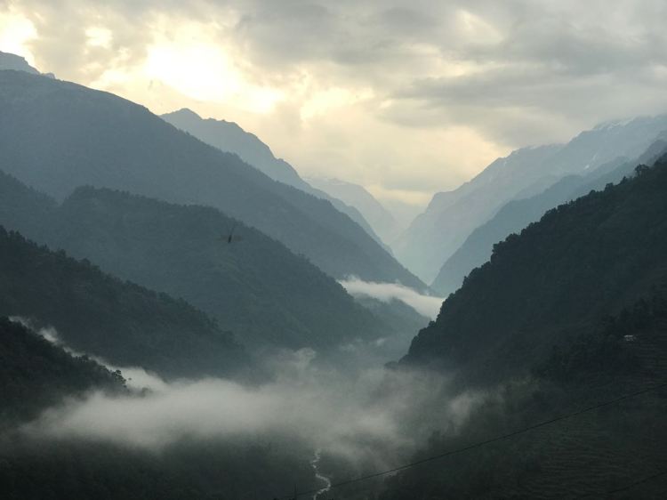
Sunrise view of Mt. Everest from Mt. Kalapatther

It is not the mountain we conquer, but ourselves” Sir Edmund Hilary.

The journey started with a short flight from New Delhi to the land of mountains, Nepal. Kathmandu. The Capital, looked none different from any of the major cities in India. Staying at Tibet guest house in Thamel offered a whole new level of excitement for Thamel is said to be the Goa of the Mountains, a paradise for Hippies and heaven for Trekkers .One can find numerous trekking shops and countless number of bars around the tiny place.

Staying at Thamel for a day and picking our last bag of gears, we started for Lukla (the place from where the trek starts) the next morning.

Day 1 (Kathmandu-Lukla-Phakding)

The day starts with flying from a 16 seater jet from Kathmandu to Lukla , Lukla airport- the most menacing airport in the world, notorious for having its flight cancelled fifty percent of times,is located among the mountains- a small airstrip where anyone can go and watch the flights takeoff without even a boarding pass. The airport has earned the category of Most Dangerous Airport in the world with an airstrip of no more than 400 m and very high wind speeds for these little jets.

dsc_0039

Tiny jets which land on Tenzing Hilary airport

We reached by 10:45 and after having a cup of tea , started descending towards Phakding. The trail lead us through countless farms and forest covers,giving us  the first glimpse of the Himalayan terrain . Walking along Dudhkosi River, we made our way to Phakding, our first stop along the trail. Dudhkosi river, as the name suggests means river of milk, and actually the water felt like milk when seen from a distance.

day1

Day 2 ( Trekking towards Namche Baazar )

Namche Baazar is the central getaway for all the treks and expeditions around the Khumbu region. The trail is a 12km long stretch going both uphill and downhill through the Sagarmatha National Park towards Namche Baazar, our next destination, the capital of Khumbu region.

IMG_20170509_175836_HDR

Namche Baazar

Traditionally, Namche Bazaar was a trading post, with locals bartering yak cheese and butter for agricultural goods grown at lower altitudes. Namche Baazar is also the most happening place in this region with lots of bakeries and pubs including the highest Irish pub in the world. Trekking towards namche gave us beautiful views of the snow capped peaks including Mt. Thamserku (6808m, still unclimbed) and our first glimpse of every trekkers dream- Mt. Everest. Having am early lunch at 11as there are no more tea houses along the way, we made way towards our destination, ascending 600 m.

IMG-20170511-WA0000

Birds eye view of Namche Baazar

Day 3 ( Acclimatization at Namche Baazar )

In order to acclimatize to the altitude, we had a rest day at Namche Baazar as it is the first place on the Khumbu trek that is above altitude sickness threshold and so most trekkers prefer to spend at least two nights at Namche Bazaar. Oxygen levels are 20% less than the sea level. We headed towards the Namche museum, a small walk uphill .The museum ,a one of its own was quite informative about Sagarmatha National Park, the wildlife in the Khumbu region, flora and fauna, and the Sherpa culture.

IMG-20170510-WA0003

Prayer Flags at namche Baazar

The hike after the museum was a steep one, giving us fabulous views of Namche Baazar from the top, crossing one of the highest airstrips in the world (Syngboche airstrip) having literally no concrete airstrip. The top gave us clear views of Mt. Everest while we were relaxing at an Everest facing restaurant .Our evening was occupied exploring the beautiful town.

Day 4 (Trek towards Tengboche)

Tengboche, our next destination- 400m higher than the previous stop, Namche bazaar. A six hour hike with a decent walk for 2 hours for the first two hours giving astonishing panorama of Mt. Amadablam all along our way.While crossing the Nepali flats (walk uphill, walk downhill and come to the same altitude) . The next phase of the trek is steep and challenging going through Rhododendron flowers and a lot of bird sightings along the way. The best part of this trek is you cannot see the destination beforehand, you keep walking and walking and suddenly to your surprise , you’ve reached.

IMG-20170511-WA0022

Tengboche monastery 

The Tengboche monastery is the largest in the Khumbu region which is said to be home to 60 monks and is considered as the gateway to Mount Everest. The chanting of monks gave us a feeling of purity and made us more positive for the rest of our journey. After entering the gateway to Mt. Everest we descend for next ten minutes to reach our next destination Debuche.

IMG-20170511-WA0016

Day 5 ( Trek towards Dingboche )

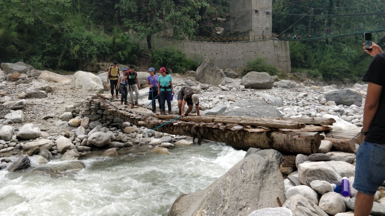
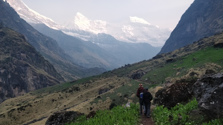
We head out of Debuche Camp and through the rhododendron bushes heading down to cross the Imja Khola, with constant sightings of Everest, Lhotse, Ama Dablam and Nuptse. Ascending a height of 600m to reach Dingboche, an easy 10 km trail , not too steep as we gain height gradually. We crossed the forest line and now the vegetation only consisted of small Juniper bushes as if it was a cold desert, one of the most beautiful paths of the trek.

At a height of 4400m it’s common to have symptoms of mountain sickness and many people head back because of the same, headache and loss of appetite being one of the common symptoms.  Dingboche , a place with two stupas and around seven-eight tea houses, accommodates trekkers on their way towards the Base Camp.

IMG_20170513_090745_HDR

Day 6 ( Acclimatization at Dingboche )

Rest day at Dingboche in order to acclimatize as we have crossed 4200 m mark above sea level . Rest days are not meant to relax at the tea houses, but for  fun hikes in order to acclimatize well. The fun hike is halfway towards the Nangkartshang peak , which is at a height of 700m above Dingboche, some of us went down past halfway while the rest stayed back to trek to the top of the mountain to gain an altitude of around 5000m . The hike was quite steep and challenging, but that’s the aim, to cross your limits each day. The course offers beautiful views of Mt. Amadablam , Mt. Makalu, Mt. Thamserku, Mt. Lohutse and also Mt. Chu Yu (Half in Nepal, Half in China).

View from nangkartshang

View from Nangkartshang peak

Day 7 (Trek towards Labuche)

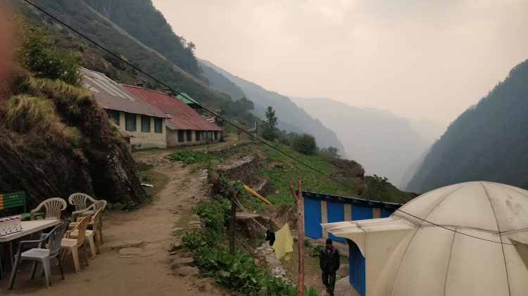
This is the last stop before ascending towards the Base Camp , Labuche at an altitude of 4950m. The day was cloudy and windy and sun couldn’t be seen . The trek started with steep uphill for some minutes and then a long straight walk to a point named Thukla Dukla , During the walk there was mild snowfall which was the only thing missing in the trek. We stopped at Thukla Dukla to have tea and snacks.

IMG_20170514_081021_HDR

On the way to Thukla Pass

As we ascend up from Thukla pass we see multiple memorials of people who lost their lives while climbing Everest, including memorial of Babu Chiri Sherpa who had climbed Everest 21 times and holds three world records for the same.

IMG_20170514_141420_HDR

The youngest member in our group at memorial above Thukla pass

Day 8 (Trek towards Gorakshep and summit the Everest Base Camp)

The day started earlier than usual, around 6:30 since it is supposed to be the longest day of our trek, walking around 10 hours at an altitude above 5000m . The first destination is Gorakshep which is a 3 hour walk from Labuche, where we had our lunch and kept our bags to head towards the final destination, The Base Camp. Throughout the way towards Gorakshep, one can see Mt. Pumori, which triggered the avalanche in 2015 and the Khumbu glaciers throughout our way.

View on the way towards gorakshep

Trekking towards Gorakshep

Another three hour long journey still awaits for us to reach the Base Camp giving awe-inspiring views of Mt. Pumori, Mt. Khumbuche, Mt. Nuptse, Mt. Lolo, and Mt. Dolo. Reaching BC at 14:30 gave all of us a sense of accomplishment as the wait has come to an end and this was the result of seven day struggle throughout the trek, the feeling was exciting and beautiful, like one of the toughest things in life is finally achieved , with everyone, overjoyed with emotions.

IMG-20160604-WA0001

Me standing at Everest Base Camp

It was surprising to see that all the tents on the Base Camp were pitched on ice in front of the Khumbu Icefall, the place where temperature is zero or below giving you shivers while you walk. The camp was full of tents with climbers from all over the world attempting Everest this year after two consecutive years when Everest was unreachable. Our way back to Gorakshep was also an thrilling experience as it started snowing heavily as we left the Base Camp , the path we covered in the morning was brown, while our way back, it turned white everywhere.  We all were really happy as we made it at the right time before the snowfall.

Everest Base Camp treks

Camps at Khumbu Glacier

Day 9 (Descend towards Periche)

Day started with few of our group members ascend towards Kalapatthar (5550 m) to see sunrise from Everest- the most stunning view among all, rays of sunlight falling from Everest – one word to describe – FANTASTIC. After returning we started descending towards Periche , again a small village with only few tea houses.

IMG-20160519-WA0025

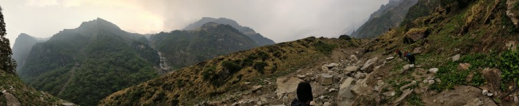
Panaromic view from Gorakshep

Reaching Periche by afternoon we got to know that here is clinic of Himalayan Rescue Association and every noon at around 3 pm they have this session on high altitude sickness in which they taught us about the symptoms of Acute Mountain Sickness (AMS) and how to resolve them. The lecture was quite informative, especially for a guy like me who wants to make a living climbing mountains.

Day 10 (Periche to Namche Baazar)

One of the longest walk of our trip, covering 20 kms to reach Namche Baazar from Periche , walking around for 10 hours. Bidding our farewell to all the heavenly mountains around us. Until Debuche the walk was quite easy but it after that it was going to be steep downhill , uphill and a long walk to reach our next destination Naamche Baazar. This is the day you actually challenge your limits.

IMG_20170513_092730_HDR

Circular Rainbows on the way

Day 11 ( Hike towards Lukla )

Energized by the fact that this is the last day of the trek and also the last 20 kms we started heading towards Lukla. The first phase was steep downhill towards Phakding (our first stop) where we stopped to have lunch. The way was not as dusty as it was while going up because of the rain last evening and the serene changed every 20 minutes.

IMG_20170519_172059_HDR

Little Sherpa 

Crossing Phakding the trek was seven kms uphill towards Lukla , passing entrance of Sagarmatha National Park giving our final salutation to the astounding forest. After walking for three more hours we reached our last destination, Lukla , from where we have a flight tomorrow morning. After resting we went to the Everest Café to have grab some drinks, because ‘a little party never killed nobody’ and having the last never ending discussing about the trip. Tomorrow we will be back to the daily scheduled life and city noise.

IMG_20170521_082702

All the trekkers apart from me flew away in a Helicopter to have a better look of the Khumbu district and i enjoyed walking alone to Lukla. Walking alone is always super fun.

For more details about Everest Base Camp trek contact me at : prashantvatwani93@gmail.com

or put up a comment on this blog with your email id.

Hope you enjoyed reading it. 🙂
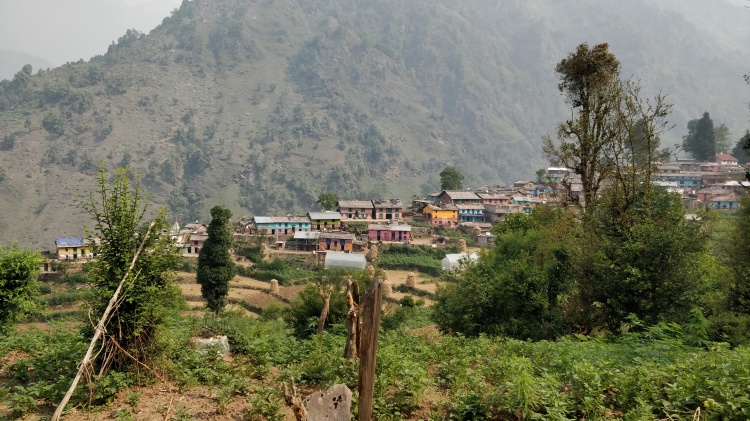
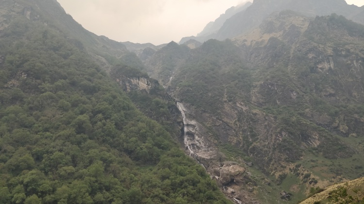
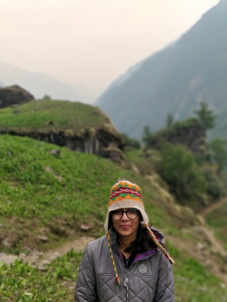
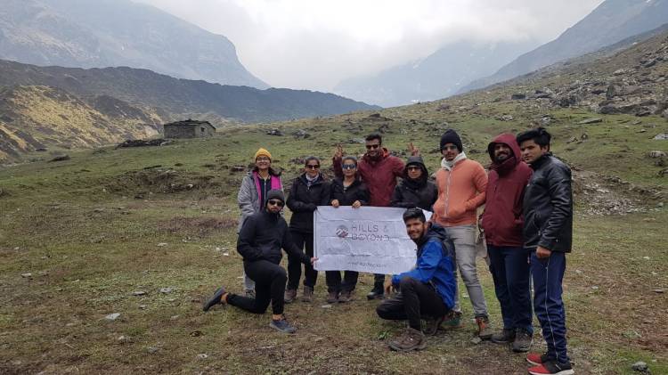
Stok La Trek, Ladakh

I had booked my tickets to Leh very well in advance and had got a great deal in booking of tickets, but till the time I wa in the flight I was unsure whether I will go or I will have to drop out. I always had this deal from my boss that if you convert this number of people for the trek, you will be able to go for free. I had matched my numbers and there was still tension in the air because now its August and I am leaving for Leh in the next three days, but there was something important that I told my boss – I will not be able to continue with the company anymore because I have to undertake this trip to North East for my mountaineering course.  For the course I had to take leave for almost 40 days which my boss was not in favor of. But as the tickets were booked, he said take this trip and then you can leave the company. Finally I landed in Leh, whatever I had heard about that place was true, its one of the most beautiful places on Earth. The raw mountains, the cleanliness, the landscape , everywhere you see is worth taking a photograph.  I had gone to Leh to be the trek leader for a small trek called : Stok La trek.  My co trekkers  were supposed to reach the next day.IMG_20170804_083155_HDR

We had two acclimatization days in Leh. Once you reach an altitude of more than 3000 m directly from sea level, you have to adapt to the atmosphere around you, there is less oxygen in the air and your body is not used to thin air.  Not exerting my body much, I just visited  the market in the evening and used the rest of the day resting and acclimatizing. The next day we went to the monastery nearby with all the clients and guides, this was an acclimatization walk, so that the body is used to walking at this altitude before the trek begins. The visit to the monastery was a good warm up exercise for me and the clients as well.  In the afternoon, we packed our stuff and started for the base of the trek.  Our bus stopped an hour before the base as I wanted everyone should get the feel of trekking even before the base of the trek and then we walked an hour to reach the base of the trek called  Zingchen. The place was one of its kind, with river stream flowing beside(a basic rule while camping : Always camp beside a river stream so that you always have access to water), the campsite was made neatly, our tents were already pitched and we have separate pee and poop tents for Men and Women (Although we only had one lady in the group). The surrounding mountains were raw, without any vegetation, I had never seen such landscape ever before. After playing some rounds of UNO, we had our dinner and went off to sleep.

IMG_20170806_181111_HDR

The next day, we had a long walk to a place called Rumbak, which was at a height of 4000 m above sea level. We started with walking on the road, then we entered the woods and started trekking. Today’s trek took us through a couple of small untouched villages of Leh Ladakh. Walking along the Indus river stream, and among the sky scrapper barren mountains felt as if there is some painting and we are walking among the painting. The change in the colors of landscape as we made our way towards Rumbuk made me awe struck. By lunch time, we reached our next destination and before we reached, our tents were already pitched and food already prepared. There was only one group besides our which was trekking to Stok Kangri, the whole ampsite was for us.  We were able to see some wildlife while on the trek and got to know about Snow Leopard, which one can see while trekking in Leh region during winters.  The night was a full moon night, the dim light of the moon showed  different view of the astonishing mountains, there was a glow in the night and the stars were shining as they used to be years ago when I was a kid, when there was less global warming. One of the best things about going for a trek is to time travel and go to the past just to realise how beautiful the world was before internet, mobile phones and when there was less connectivity, less connectivity leads to more talking to the people who are around you and you get to acknowledge the beauty of the nature around you.

IMG_20170808_140558_HDR

The next morning when we got up for the final push, climb Stok La and then descend to Changma we had a problem before starting. There was one guy in our group whose oxgen levels dropped to 55 and there was no scope for him to move forward. After turning that guy back and sending an assistant guide with him we headed towards Stok La. The path was as difficult as beautiful. When you start your trek for the day, the first hour is always very demanding as the body is getting warmed up and you feel very tired during that time. After the first hour the beauty of the walk starts. After walking on a gradually inclided slope for an hour, the real climb started when it was steep ascend. Ascending our way towards Stok La we crossed a number of ridges and different colors of the terrain, the walk was so beautiful that one should take up the trek to experience the wonders of nature. The last hour was difficult and each and every person from our group managed to get to the top just on time. From the top we could see clear views of Stok Kangri mountain and all of the stok Region. On my left were the mountains which were covered with snow, in  front of me were mountains with little vegetation and on my right were barren colorful mountains. Now the most important part of every climb : DESCEND. As rightly said by somebody, it is not necessary to reach up, but it is compulsary to come back down. The journey to Changma was quite steep and long (as this was the most important day of the trek, it had to be difficult). We walked and walked to descend but we could not see the end anywhere. All the clients started asking me why was it necessary to put up the camp so far and make the day so long, I simply said : do you see any flat place where we can pitch our tents ? Having no reply they started walking behind me in the hope to see our tents somewhere. And finally after descending for more than two hours, we could see our colorful campsite , everyone of us was completely overjoyed. We were having tea as we discussed our jourey of the day. “It was difficult they said, but it was worth it”.  There was this lady, Nandini, the only lady in the group she said “ This was really a good move by me to sign up for this trek, I have always heard about Ladakh and its beauty, but I never had a chance to get here. Now when I am here I acutally believe in what people say : KASHMIR IS HEAVEN ON EARTH . This heaven has shown me its true colors and I am really grateful to the god of nature for this. Trekking in Ladakh is what what most people don’t prefer because they usually want to sight see and bike around, but trekking in Ladakh is very important to get to know the culture when you see those villages which have no connectivity, yet they are happy in life, they demand nothing more, you get to experience the beauty of living among the mountains and the streams and get to cherish the basic necessities of life (Food – Clothing – Shelter).

IMG_20170808_135326_HDR

The next day we got up slighly late as we knew that today it’s a relatively simple trek, rather a walk of an hour to reach Stok Village from where we will be picked up by a van to be dropped at Leh.  Most of the group members chose to stay back and explore more of Leh, while some went back the next day.

I being a guy who likes to be alone had two more days in Ladakh. And they were also full of surprises. “What happens in the mountains, should stay in the mountains “ .

IMG_20170808_165936_HDR

Three days in Kodaikanal.

The trip started with 2 ac tickets and and 4 general , you can imagine travelling 28 hours in general from Pune to Kodaikanal. Travelling in general showed me many things , a poor old nice person was sitting beside us who got to know he was in the wrong train and wanted to go to Orrisa , seeing his grief, we all felt bad. Finally the next day at 8 pm we reached Kodaikanal road, around 80 kms away from Kodaikanal . We went on to find a place there cause we could not find any transport . Fortunately after many efforts and rejections we found a place to stay , Travellers Bunglow , a government cottage which was so beautiful and so huge and they just charged us with rs.500 per night for a jumbo room, hall , dining area and loo.

The next day we started from Kodaikanal road to Kodaikanal , the picturesque view on the way was mind blowing , covering lush green forests , waterfalls , lakes and many different species of flora . The rain on the first day made us stay inside the hotel till the evening so we had very less time to roam around ,therefore decided to go to the market. Kodaikanal is a very small village where you can see Homemade chocolate shops after every second shop. The lake

near the market is amazing and boating there is a must do.

IMG_20151006_180519_hdr

The second day we started with Forest Safari in Berijam Forest, which was like Paradise. It started at 9 in the morning and our driver took us to many amazing places . It included many view points which were extremely beautiful. Few places were fully covered with clouds and we were between them and Berijam Lake is amicable. Here are some images of the forest.

Do not miss the horse riding in the forest between clouds , it feels like heaven.

IMG_20151007_104751_hdr_edit

The third day started somewhat lazy and we headed to Vattaknal , a place 3 kms from Kodaikanal for trekking and a place simply amazing  You can find more tourists in Vttakanal than Kodaikanal . It was a 2 km long trek which took us to alluring views . A point named Dolphins nose is a place with a 6600 feet deep drop down cliff which was on the mid way, was one of the points we’ve heard of a lot should not be missed . And the last point in the way was so beautiful which gives you a natural high there , you don’t need any alternatives . Sit at that point for sometime and you can realize that nature is just made for you individually . Also there was a waterfall which was very amazing between the woods .

IMG_20151008_134737 IMG_20151008_113330_hdr IMAG0154

God has gifted us with so much beauty and scenery , if you don’t travel you’re just reading the first page.